
D15 (20.6.2013) - Bush camp in Sandy Rio Carvalhoa - Namibe, 80 km)
Today's stint started with the 80 km towards Namibe. This is the main road in Namibe.
We found the camp site on the coast in Namibe. As in all of Africa, the camping fees needed to be negotiated.

This is the camp site, the beach is next to it and its garden is well-kept. However, the ablutions were out of order so we had to rent a room in order to have a shower. The water wasn't potable either (so we boiled our drinking water).


This fort-like building is now the governor's private residence.

Does this mean 1100? The paving was beautiful.

We found an internet cafe and the internet actually worked!

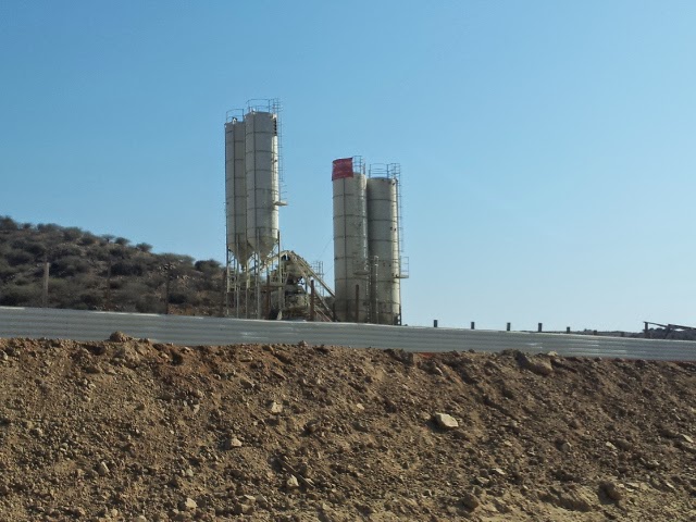
This generator tells one that Namibe's electricity supply isn't so dependable.

School children throughout Angola wear similar "dust" coats to school.

We visited the "Paderia" / bakery several times! Fresh "pao" are delicious!


D16 (21.6.2013, Namibe - Baba - bush camp near Mariquita Bay, 139 km)
We didn't find out what the purpose of this magnificent building was - but it exuded a space-age atmosphere.
A view of the harbour.

One of the old colonial buildings in Namibe - magnificent!

A typical street scene.

Road-side shopping always includes bartering.

We continued north - here are some of the scenes we passed.


Chinese hats are used by many of the road workers.

Solar panels to power street lights.

A derelict factory

Our first port of call was Baba/Babe.

We left the tarred road turning westward towards the sea. The surroundings filled us with awe.


Babe, a small fishing village.

These fish had been caught that very morning.

To be dried for use at a later stage.

The above is one side of the village's character. The other side: very posh!

However, very soon: "No Photos!" Finger-wagging but friendly - apparently Babe is the seaside retreat for some important officials. Their houses were really upmarket!

We drove to the top of the cliffs overlooking the sleepy little village. The views can never be captured on film.


Inevitably we could fit a teatime in as well.

Many roads lead back to the main road - take your pick!

As soon as possible, we left the main road again towards another gem on the coast.

The veld had changed. These Pachipodiums (?) were dotted all over.


A different variation

The colours were indescribably beautiful.


We camped in this awesome area.

D17 (22.6.2013, Ponta de Mariquita - Bentiabe - near Lucira, 173 km)
Donkeys grazing wild.

More breathtaking scenes:


We were on top of the plateau - the road down in the valley must lead to the sea shore.

Lichen

The road meanders on and on ...

Only a ravine between us and the sea?

The edge of the ravine. Beautifully stacked.

The San sat in these circles many moons ago.

Down below - the perfect place for a seaside hide-out.

Is this the point of no return - or should we name it Angola's Finisterra?


This crack is the where the cliff's next edge will be one day.

Nature's lace.

Back to our trip's reality: a tar road leading north with many Chinese bridges to cross.


Charcoal - a means to survive. Who can complain if this ensures people's livelihood?

Can one be happy living under these circumstances?

The sea again.

We deviated to Bentiabe - why? To see Bentiabe, to hand out tracts (one man asked us for a Grande Biblia which we didn't have), to see the TV dishes. Lifestyle is a choice.


Then onward to the north, to the Zona Verde (green valley) of Paul Theroux's book - how drastically different his Angola of 2008 is from the Angola which we found in 2013. Viva, Angola!!

The new road allowed for speed and death - when we left the tar road to take a tea break, we saw a body in rigor mortis with a motorcycle wreck on the embankment. The police were there to deal with the situation.

D18 (23.6.2013, Lucira - Binga Bay, 80 km)
Today we continued north, hugging the west coast of Angola as closely as possible. Always good to check tyre pressure before a day's trip!
The red cliffs near Lucira had been an excellent camping spot.

The Chinese were building roads and bridges from the south to the north in Angola - throughout the whole of Angola as we were to discover later in our trip. But from here on we had a stretch of dust road.

Cattle have right of way even if the herdsmen try to shoo them out of our path.

We planned to have a camp fire tonight. Another use for a spare wheel!

We were definitely on the right road to Binga Bay. It must be a fishing village.

Why all the road works on this side road?

This sign explained it all - just a pity our Portuguese was non-existent. But we think that Binga Bay was now a concession area registered to Bezi-Bezi Safaris, Lda. Presumably that means that soon one will not just be able to drop in to the bay.

As we drove towards the sea, it soon became clear to us that Binga Bay was a prime destination combining beauty and challenge.


The road down to sea level. GPS/T4A wording: DANGEROUSLY STEEP. We went down cautiously, but we decided that the wording was far too dramatic for the reality of the decline.


Only ruins greeted us although people lived in some of these ruins.

We needed to cross this stretch of beach so that we could camp in the river valley and be protected from wind. The men walked across to plan the best route.


Our camp site was perfect.


D19 (24.6.2013, Binga Bay - Benguela - Lobito, 210 km)
This morning we inverted the road to leave Binga Bay: we crossed the sand and climbed the hill. Back to the main road which leads north.This is the view we had from our "bathroom" at Binga Bay.

Goodbye to our Binga Bay camp site.

Look forward and see the road down there, look back in the rear view mirror and see the sea - amazing how the different the world looks from various perspectives.


The main road leading north was also in the process of being upgraded.

It carried heavy traffic.

The Dombe Grande Pass gave us a wonderful view into the valleys even though it was only +-500m high (see graph below). The dirt road made the pass feel quite scary - we averaged 20 km/hr! Perhaps it was the oncoming traffic that stormed down on us and scared us??


Bridges offer good shade for tea.

This couple was dressed to the nines and were willing to pose for us. If only we could speak to them!


Road works.

And back onto brand new tar.

The Green Valley which stretches +-120km south from Luanda seemed to begin here.

Near Benguela we passed a salt pan.

Fuel, fuel everywhere - at the princely price of R4/L for diesel. Petrol at R6/L.

We reached Benguela and had a look around.


Once again the road sign told us we were on the right road heading towards Lobito.


Zulu Restaurant where we were headed was beyond the harbour.

Zaire, the boat in which young nationalists (dos Santos, the present day president was one of them) set sail in 1961 to sensitize fellow citizens about their right to a democracy.

We found Zulu Restaurant just behind the boat. We knew that 4x4 travellers camped on the beach directly behind the restaurant. The night watchman was rather surprised to see us on a Monday evening - officially the restaurant is closed on a Monday.


A glorious sunset rounded off a perfect day.

No comments:
Post a Comment