Still going south. We left our bush camp next to the Kunene river and skirted around the Bicuar National Park for three reasons:
1. It had been used for target practice during the civil war and there was still hardly any game to be seen.
2. There wasn't an obvious road through the park.
3. We had been told by Bruce (who had a friend recently put in charge of the park) that the entrance fee was exorbitant and that overnight camping was not permitted in the park.
Enough said.

D46 (2013.07.21, Matala - N of Shangalaha, 136km)
We had fortunately risen by the time the nearby construction site guards came to check up on us - they were responsible to know who was in the area. We thanked them for keeping an eye on us!

The Kunene River towards the south as we re-crossed the bridge to town.

As Matala is quite a sizeable town, we decided to find an official dump/bin for our accumulated rubbish. After driving through town, we eventually found bins on an open stand overflowing with rubbish.

We passed the petrol station where many ever-present motorbikes were queuing in an orderly manner for petrol.

We headed south once again. Most of the road was rough. Is rough the right word? Perhaps rutted would describe the road better? And then the word "donga" crosses my mind - in many cases the going took serious concentration as the road was a vehicle/tyre cruncher.
In spite of the bad road, we saw many interesting sights:
a brand new storage/silo

Strips of tar - it's much better to drive next to them!

A beautiful little church with the Unicef water tower on the town island.


Different types of "lacy" road.


Canals from the Kunene. They seem to be used mostly for washing, although there are some cultivated fields in the vicinity.


Some of the canal water seems to end up in the road!

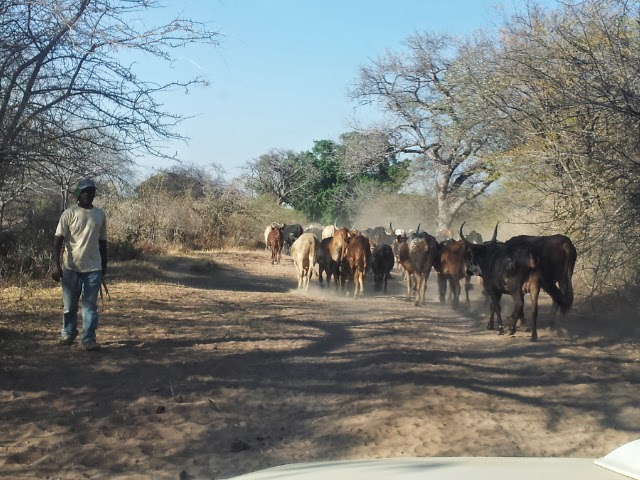
Along the road, we see more of the same: cattle, people, motorbikes, road signs.


Even minute villages proudly fly the Angolan flag.

A rural maize storage system.

A magnificent tree in full blossom.

A typical dust road - much better to negotiate than the bits and pieces of tar we had to travel on this morning.

This seems to be a headman's statue.


This bare-necked hen and her bare-necked chicks took no notice of us.

Five o'clock - time to camp. Where? We found another field tucked behind a hedge next to the road. Nobody saw us although we could hear the odd passing vehicle. It was amazing how easily and safely we bush camped in Angola.

D47 (2013.07.22, Bush camp N of Shangalaha - cemetery camp S of Xangongo, 136km)
We had spent the evening listening to the passing traffic - but as we were behind a thick hedge - nobody even realised that we were camping in the field next to the road.Guess in which direction we were headed on our next stint? Yesss - south!
Some sights along the way. Just look at the change in road surface - never a dull moment:


We were obviously getting closer to civilisation: we passed some trucks transporting cattle, saw tidy schools and met a few cars on the road.


Angola is upgrading their road system so this was a sign we knew well: Desvio. Sometimes it seemed to mean "take your pick" as the detours were not always obvious.


TV disc on a shack!

This good tar road was the same one we had driven on at the beginning of our trip!

We crossed the Cunene again.


As you can see from our map, we left the tar road and headed towards Ruacana as we had decided to spend the last few days of our tour in Kaokoland. This meant that we were back onto dust roads and passed rural people living their daily life.

This lovely open spot was just far enough from the road to be private. It turned out to be in the close vicinity of a graveyard. Can you see the cross just below the sunset?


Instead of catching ghosts, we "caught" the moon! After this, we slept well.

D48 (2013.07.23, Cemetery camp S of Xangongo - Ruacana, 160km)
No ghosts bothered us in our "cemetery" camp, so we packed up and started the last leg of 160 km to Ruacana.Angola is a country of opposites: progress (new schools) and ruins (bombed out buildings).


This church has a unique design but didn't seem to have been completed.

Some of the other sights along the way: a massive baobab tree, a fully functioning school under a tree.


We realised that we must be close to Ruacana when we saw this pipeline and bridge.


More sandy roads and wonderful rocks along the roadside. A picturesque row of baobabs - all shot on the go! Viva, my Samsung cell phone!


An Angolan Himba family - they were pleased with the money we gave them.


The Ruacana dam and the holding wall.


Ruacana border post.
On the Angolan side of the border the officials were very friendly, but couldn't understand that our letter of invitation had stipulated 6 names, whereas we were only 4 persons standing in front of him. "Where are the other 2 people?" Mrad challenged the official to solve our problem (the other couple had left Angola prior to their 30-days visa expiring). The official made a "phone call" to Luanda and within seconds had established that our friends had left Angola via another border post. Either the cumbersome Angolan bureaucracy had dramatically changed for the better, or the official had seen that his effort to bribe us wasn't paying off!?!?
With mixed feelings, we said "Good-bye" to this wonderful country.
On the Namibian side they did not have the correct forms for us to purchase TIP for our vehicles, so they recommended that we go to Omahenene border post the next day to buy this document. However, as they stamped our passports we officially were allowed to enter into Namibia.
