We had slept near Arco (circle left top of map), visited Arco itself and then followed a brand new road into the park - see the north-east route.

D11 (16.6.2013, bush camp via Lake Arco, heading towards Iona National Park, 145 km)
The road to Arco took us deeper into the lunar-like landscape.

As we drove east towards Arco, we passed a small settlement of shacks, but the Angolan flag validated their existence.

We parked near Arco and found the footpath leading to the famous arch.

The "lake" (sometimes seen through the arch) was dry, yet the surface showed us that it was a lake bottom.


The famous "Arco" actually consisted of two arches! Both were equally impressive. The two arches create a sci-fi mask effect! Can you see me in the right hand arch of the second photo?


We returned the way we had come - back to the main SN road. After rejoining the tar, we passed this sign and found the second one (one new and the other old?)


We found a good spot for lunch.

The road led us downhill toward a small village, Shambasana, which nestled next to a lake.


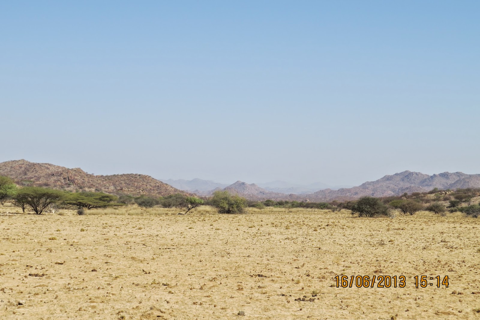
As we drove east, the scenery and colours of the soil became very special.


Here we realized that Welwitschia were not an odd occurrence in this part of Angola. On the contrary we became used to seeing "forests" of these prehistoric-looking plants.

We also joined the new Chinese road (the NE road on the map at the top of the post).

This new road which was in excellent condition led us towards Iona NP which is managed in collaboration with resident villagers.

The area had lovely surprises for us - just look at the dolerite mound in the middle of nowhere.

Goats seem to be able to survive well in these harsh conditions.

What could have caused these rocks to have these shapes?

These villagers use donkeys to fetch water in bright yellow containers.

The road works had not been totally completed. Perhaps a tar layer is still to come?

Beware - even a good Chinese road can have deep sandy patches! Quite a wake-up call!

We knew of this camp site, but when we phoned to book there was no answer. So we took pot luck - found the gate securely locked and simply drove on to find a bush camp. No problem.

Wow! Just look at these two Ru"ppels Korhaans (Woestynkorhaan)!

A Springbok resting in the shade.

A glimpse into eternity!
A Pale Chanting Goshawk checking us out.

Simply beautiful.

We found a lovely camping spot just off the road. Nobody in sight and plenty of room for three vehicles.

D12 (17.6.2013, into Iona NP, Espenhiera, 83 km)
Our trip started with a "Goodbye" to one vehicle whose occupants had forgotten to fill up their diesel in Namibe. They would stay in the vicinity of this camp and we would continue on to Espenhiera - the local ghost town.
Never pass a water point - we enjoyed filling containers with this water although it was brackish. We could use it for anything but drinking (although I'm sure the local population would not have agreed with us!).

At last we found the entrance gate to Iona NP, but no matter how loudly we called, nobody came to the gate and we eventually simply drove through.


Just look at the many animal tracks along the road side. However, your guess is as good as mine - we never found out to whom the tracks belonged.

Further south, the terrain became more hostile and impressive. Feldspar? Wish my geological knowledge was up to scratch!
Our road ran straight through this intimidating terrain, but many previous vehicles had flattened any danger - even euphorbia-like plants happily grew here.


A lone little Baobab happily blossoming despite its dire surroundings.

When last did you see such a magnificent pair of horns?

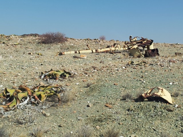
More Welwitschia and a war wreck.

There weren't many turn-off roads so one couldn't really get lost, but it was still good to see that our goal (Espenhiera) was signposted. We laughed: "Imagine finding a signposted ghost town!?!?"

Here it was. The ghost town Espenhiera was losing its ghostliness because it seemed to be newly renovated and inhabited although nobody was home - only some washing was on the line.


Should you want to go to the Cunene River mouth, then you would need to go through Espenhiera.

Here are some of the sights around Espenhiera.


We camped in the plain below Espenhiera and enjoyed the sunset.


D13 (18.6.2013, S of Espenhiera, Iona bush camp, 119 km)
We had hoped to reach the Cunene directly south of Espenhiera, but we were over-ambitious and returned to our friends the next day.However, we managed to explore a few kilometres SE towards the village Iona. The scenery continued to enchant us.

A magnificent alluvial fan.

Lunch in a dry riverbed.

A dolerite outcrop.

More enchanting scenes:


Real fairy circles. How had we missed them on the way south?
Apparently a specific type of ant denudes the soil in the circles of vegetation which allows all moisture to seep down into the sand thus building a reservoir for the ants to survive the droughts of the area. The bonus is the grass growing around the rim of the circle (due to the captured moisture) - and voila! - the ants have a store of food too! Read more about this miracle on http://arstechnica.com/science/2013/03/by-building-fairy-circles-termites-engineer-their-own-ecosystem/. Dankie vir die link, Siep!

That evening we had a most magnificent sunset.

D14 (19.6.2013, Bush camp Iona NP - old road - Bush camp N of Rio Carvalhoa, 96 km)
We could have stayed in Iona for a month - there was so much to see and experience - especially as it felt as if we had visited a part of heaven.
Here are some of the scenes from our day north back to civilisation.

This army wreck was logged on GPS by T4A.

We found this "monument" packed out with small white stones. I turned the photo upside down so that the words can be read - if you can read Portuguese!?!

Men were inspecting the fazenda's (farm) fence and the owner and his family were there to supervise their work.


The old road was quite rough, but it was exciting.


This pile of stones is a tribute built by travellers who have braved this road and visited Iona NP. Needlessly to say our stones also landed on the pile.


Wikipedia states that the biggest Welwitschia is 1.4 m high - this one seems to be near 1.6 m!! (Mrad is 1.78 m tall).

Just look at the different colours!


Teatime!

Another warning!

A peek into eternity.

Could that be the back of the sandstone mountain where the Chinese road starts?

Yes! Lo and behold - the beginning of the Chinese road where our trip into the desert began. Mrad confirmed this insight by holding his arms in a giant C-shape!

A graveyard on the outskirts of Shambasana.

We passed the little village of Shambasana which lay next to the Kuroca Lagun. That evening we slept in the dry riverbed of the Rio Carvalhoa.


No comments:
Post a Comment